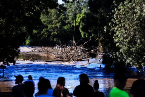
Sydney may have woken up to blue skies on Saturday, but flood levels were continuing to rise across parts of New South Wales with evacuation orders issued after an overnight deluge broke rainfall records.
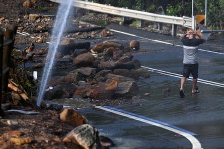
Suburbs on the city fringes were facing the threat of significant flooding after copping more than a month’s worth of rain while a major landslip in the Blue Mountains left one community cut off.
The premier, Chris Minns, called for caution, noting just under 4,000 volunteers “spent the night in the cold and windy and rainy conditions, saving people’s lives”.
Warragamba dam, which holds most of Sydney’s water supply, reached full capacity and began spilling early on Saturday morning – two days earlier than predicted.
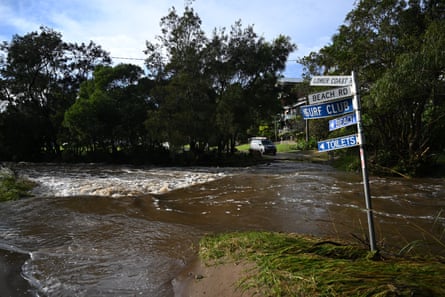
Levels at the dam were expected to peak at midnight on Saturday, but the New South Wales State Emergency Service commissioner, Carlene York, said communities along the Hawkesbury-Nepean river system would be “feeling that for the next few days”.
Evacuation orders were issued by the SES for 11 locations overnight on Friday and Saturday morning, including along the Hawkesbury-Nepean, low-lying parts of Chipping Norton in western Sydney and North Narrabeen on the northern beaches.
“While it looks like blue skies across Sydney at the moment and the emergency rain situation seems to be easing … it is important to note that flood levels in some of the rivers, particularly in western Sydney, are continuing to rise and that presents a danger for some communities,” Minns told reporters on Saturday.
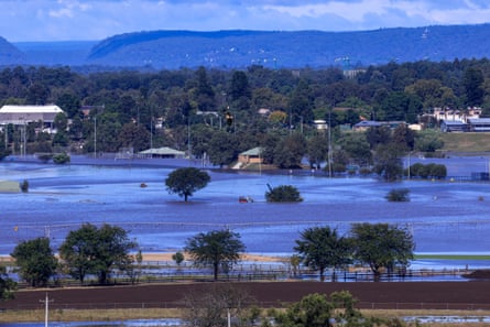
The Bureau of Meteorology’s Steven Bernasconi said three rivers were likely to continue to rise, including the Hawkesbury at North Richmond, which was at moderate flooding but could see major flooding on Saturday afternoon.
Bernasconi said the Hawkesbury River at Windsor and the Colo River were also predicted to continue to rise, despite the deluge moving southwards.
The rain and wind threat was “contracting to the south-east”, he said, with “the coast and ranges down in the south of NSW … areas like Moruya and Narooma” receiving most of the rain.
The SES was involved in 152 flood rescues by Saturday morning, including 72 in metropolitan Sydney, and had received more than 4,000 calls for help over the past 24 hours.
Some parts of Sydney were hit with 200mm of rain, with Darks Forest in the Georges River basin hit with a 229mm deluge in 24 hours.
The Cooks River burst its banks at Earlwood after 7am on Saturday, triggering road closures and early morning traffic.
Bernasconi said the situation was easing with heavy rainfall starting to move out into the Tasman Sea.
But flash flooding and landslips remained a concern for Wollongong, the Illawarra and the south coast with two people reportedly taken to hospital after a home at Mt Kiera washed into a creek.
after newsletter promotion
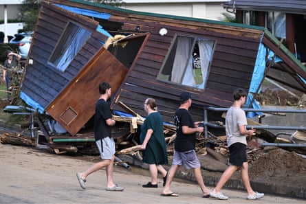
In the Blue Mountains, a landslip on a primary access road left a community cut off with authorities scrambling to arrange food drops.
“It’s the only access in and out of the valley,” Mike Davis, the owner of nearby vineyard Megalong Creek Estate, said.
“A lot of people are down here camping or in Airbnb’s at the moment so they need to do something fast.”
Around 40,000 homes and businesses lost power over the past 24 hours with fallen trees and powerlines further interrupting supply, Ausgrid said in a statement.
York said the SES was working with communities affected by the evacuation orders and would dedicate resources in southern parts of the state.
Up to 150mm of rain remained possible within a six-hour period for areas stretching hundreds of kilometres from the Blue Mountains to Narooma.
“The areas of our priority at the moment are … towards Wollongong, Illawarra and down into the south coast as this system continues to move down the coast and hopefully very soon out to sea,” York said.
Heavy rainfall and possibly severe thunderstorms were also battering southeastern parts of Queensland on Saturday and were expected to continue throughout the weekend.
Surfers and other beachgoers were warned to stay “well away from the surf and surf-exposed areas” due to dangerous conditions, particularly at east-facing beaches.
⛈️Storm forecast for tomorrow (7 April 2024): Severe storms with heavy rainfall possible over #SEQld, including #Brisbane, #GoldCoast and #SunshineCoast in the morning.
— Bureau of Meteorology, Queensland (@BOM_Qld) April 6, 2024
Severe storms with heavy rainfall also possible about the SE interior, the Wide Bay and central QLD coast. pic.twitter.com/nihTJJEjqn
The BoM’s forecast for Sunday indicated possible severe storms with heavy rainfall over south-east Queensland, including Brisbane, the Gold Coast and the Sunshine Coast in the morning.
